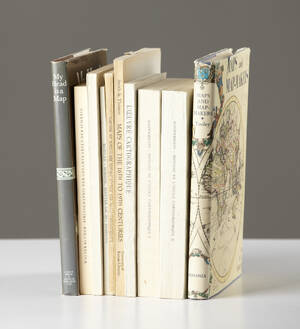
Maps and Map-makers
BIBLIOGRAPHY. MAPS. (10). TOOLEY, R. V. Maps and Map-makers. New York (Bonanza Books) 1962. . 107302.
- 2011-12-16 00:00:00
- Stockholms Auktionsverk
- Länk till objektet
Slutpris:500 SEK
Avslutade auktioner liknande Maps and Map-makers

18th Century Lotter maps of Poland and Russia
MAPS, (2), TOBIAS CONRAD LOTTER, Map of Northern Poland, Borussiae Regnum Complectens Circulos Sambiensem, Natangiensem et Hockerlandiae nec non Borussia Polonica Exhibens Palatinatus Culmiensem, Marienburgensem, Läs mer...
- 2019-03-09
- Stockholms Auktionsverk
- 1 800 SEK
18th Century Lotter maps of Poland and Russia
MAPS, (2), TOBIAS CONRAD LOTTER, Map of Northern Poland, Borussiae Regnum Complectens Circulos Sambiensem, Natangiensem et Hockerlandiae nec non Borussia Polonica Exhibens Palatinatus Culmiensem, Marienburgensem, Läs mer...
- 2017-12-17
- Stockholms Auktionsverk
- 900 SEK
Large map of Berlin Schleuen 1757
LARGE MAP OF BERLIN. Schleuen, J. D. / Schmettau. 1757. Engraved wall map of Berlin with 4 smaller maps and many important buildings on the Läs mer...
- 2017-01-21
- http://www.stadsauktion.se
- 3 400 SEK

Mount - Page Spain 2 maps / charts
MOUNT-PAGE (2). A chart of the sea-coast of Spain from cape de Gata to cape S. Martin. And of the sea-coast of Barbary... London c. Läs mer...
- 2021-05-03
- Stockholms Auktionsverk
- 400 SEK

Guides etc, Mexico and South America, 11 vol.
GUIDES ETC, MEXICO AND SOUTH AMERICA (11). FAIRFORD. Peeps at Many Lands. Cuba. With Twelve Full-Page Illustrations in Colour by Claude Pratt. London, 1913 (somewhat Läs mer...
- 2020-03-29
- Stockholms Auktionsverk
- 450 SEK

18th and 19th century maps of Germany
MAPS, (3): (ANONYMOUS) Deutschland nach seinen zehn Kreisen vornemlich, sur deutsche Stadt- und Landschulen, Erlangen 1790, engraved map, coloured, c.440x550 mm, mounted in passepartout, . Läs mer...
- 2017-11-12
- Stockholms Auktionsverk
- 700 SEK

Maps I-II to Hedin´s Southern Tibet
TIBET. (2). HEDIN, SVEN. Maps I-II (from "Southern Tibet. Discoveries in former times compared with my own researches in 1906-1908".) Stockholm (Lithographic Institute of the Läs mer...
- 2019-10-13
- Stockholms Auktionsverk
- 2 200 SEK

Karta Västerbotten 1800-tal
Karta över Västerbottens län Sammandragen och författad av P.A Kjellerstedt 1870-1878 Kartans mått: 100 x 71 cm Konditionsrapport: Bruks- och åldersbaserat slitage, veck, revor och Läs mer...
- 2022-03-31
- Norrlands Auktionsverk
- 550 SEK

Four 18th century maps of Eastern Europe
MAPS, (4), all published by LAURIE & WHITTLE, London:. All with central folding marks. A New Map of the Electorate of Bavaria and A New Läs mer...
- 2019-03-09
- Stockholms Auktionsverk
- 1 800 SEK

Three maps of The Netherlands and South America
MAPS, (3), all published by LAURIE & WHITTLE, London:. All with central folding marks and margin tears to the fold. A new map of the Läs mer...
- 2019-03-11
- Stockholms Auktionsverk
- 1 400 SEK